


Voting District 100002, Fulton County, New York
About
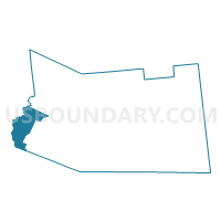
Outline

Summary
| Unique Area Identifier | 627292 |
| Name | Voting District 100002 |
| County | Fulton County |
| State | New York |
| Area (square miles) | 19.19 |
| Land Area (square miles) | 18.93 |
| Water Area (square miles) | 0.26 |
| % of Land Area | 98.62 |
| % of Water Area | 1.38 |
| Latitude of the Internal Point | 43.09357300 |
| Longtitude of the Internal Point | -74.72727730 |
Maps


Graphs
Select a template below for downloading or customizing gragh for Voting District 100002, Fulton County, New York


Neighbors
Neighoring Voting District (by Name) Neighboring Voting District on the Map
- Voting District 100001, Fulton County, NY
- Voting District 100001, Herkimer County, NY
- Voting District 100002, Herkimer County, NY
- Voting District 100003, Herkimer County, NY
- Voting District 110002, Montgomery County, NY
- Voting District 120001, Fulton County, NY
- Voting District 150001, Herkimer County, NY
Top 10 Neighboring County Subdivision (by Population) Neighboring County Subdivision on the Map
- Manheim town, Herkimer County, NY (3,334)
- St. Johnsville town, Montgomery County, NY (2,631)
- Salisbury town, Herkimer County, NY (1,958)
- Oppenheim town, Fulton County, NY (1,924)
- Stratford town, Fulton County, NY (610)
Top 10 Neighboring Place (by Population) Neighboring Place on the Map
Top 10 Neighboring Unified School District (by Population) Neighboring Unified School District on the Map
- Little Falls City School District, NY (7,343)
- Dolgeville Central School District, NY (5,362)
- St. Johnsville Central School District, NY (3,324)
- Oppenheim-Ephratah Central School District, NY (2,725)
Top 10 Neighboring State Legislative District Lower Chamber (by Population) Neighboring State Legislative District Lower Chamber on the Map
Top 10 Neighboring State Legislative District Upper Chamber (by Population) Neighboring State Legislative District Upper Chamber on the Map
Top 10 Neighboring 111th Congressional District (by Population) Neighboring 111th Congressional District on the Map
- Congressional District 21, NY (679,193)
- Congressional District 23, NY (664,245)
- Congressional District 24, NY (657,222)
Top 10 Neighboring Census Tract (by Population) Neighboring Census Tract on the Map
- Census Tract 9705, Fulton County, NY (4,216)
- Census Tract 110.02, Herkimer County, NY (3,217)
- Census Tract 724, Montgomery County, NY (2,631)
- Census Tract 110.01, Herkimer County, NY (2,075)